 Skip to main content

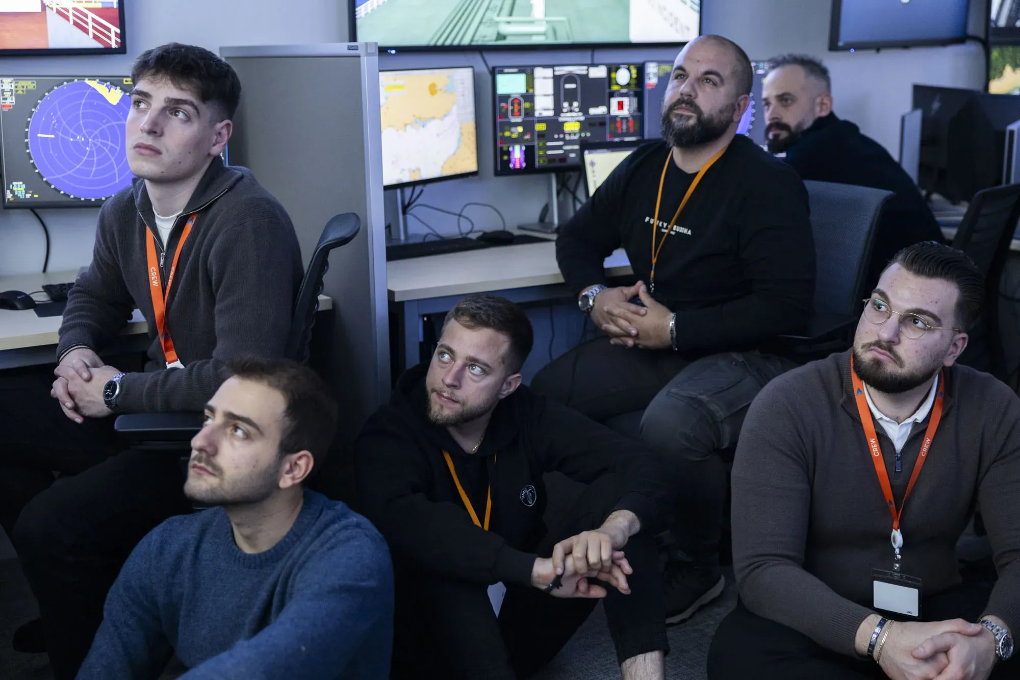
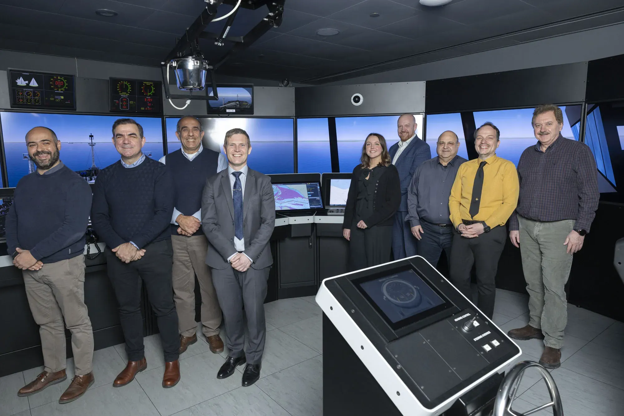
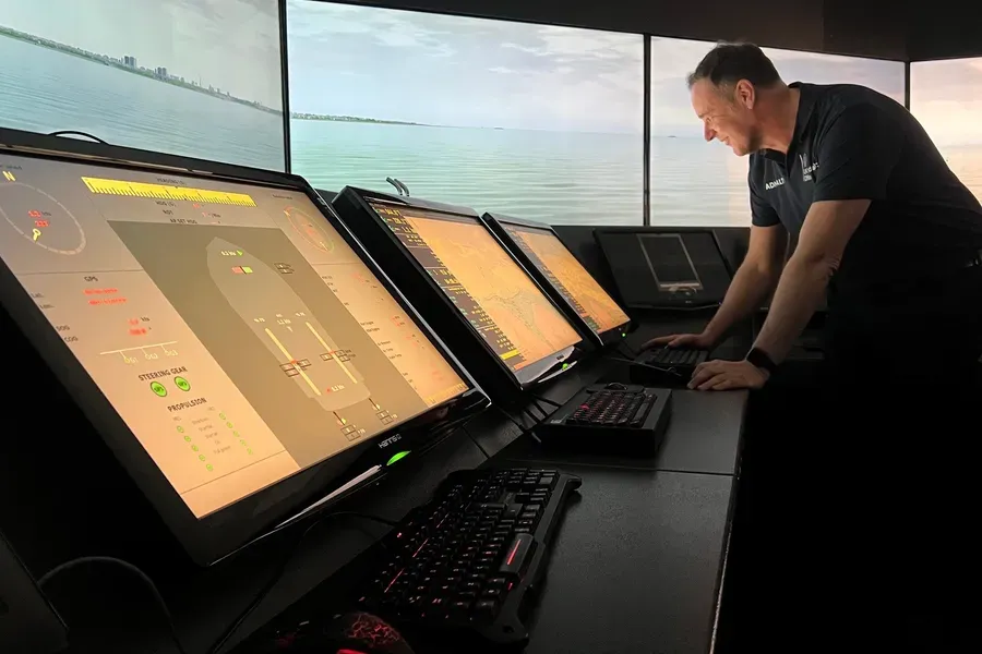
In March 2026, the UK Hydrographic Office (UKHO), in collaboration with NorthStandard and ship operators Minerva Marine and the Angelicoussis Group, carried out S-100 simulator trials in Athens, Greece.
Exploring how S-100 performs on the bridge with commercial operators
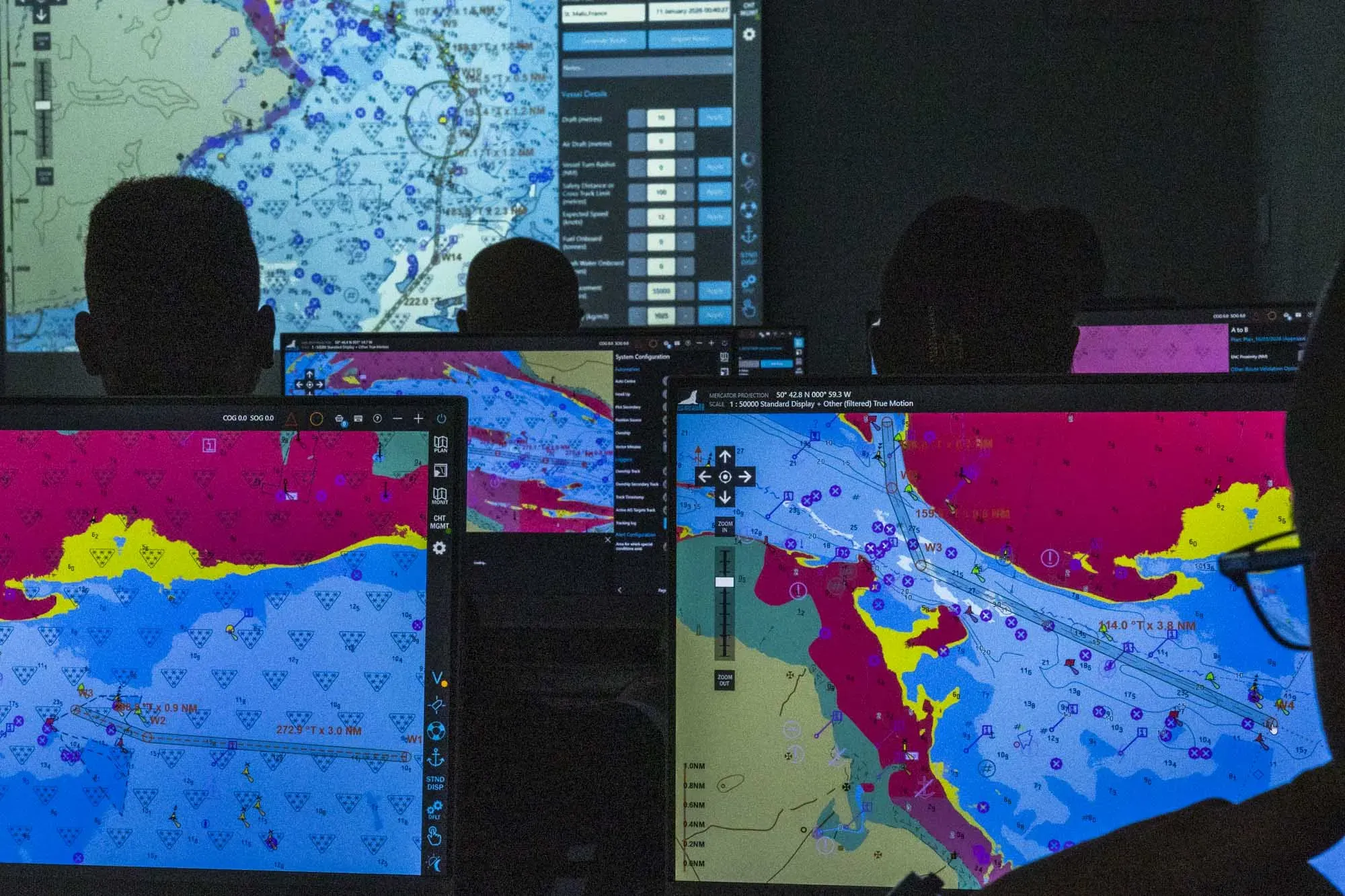
Working with bridge teams from tanker, LNG and dry bulk fleets, the trials placed S-100 data into realistic navigation scenarios using full mission bridge simulators. Crews were able to plan and execute passages, compare S-57 and S-100 side by side, and assess how additional data layers influenced their decisions in practice.
Why testing S-100 with commercial mariners matters
As S-100 moves towards operational use, understanding how it performs in real-world conditions is increasingly important.
These trials focused on the experience of the mariner: how information is presented, how decisions are made and how different data layers support navigation in practice. By working directly with active seafarers in a structured training environment, the UKHO and its partners gathered practical feedback on where S-100 adds value, particularly in areas such as clarity, situational awareness and passage planning.
The trials in Greece also reflect the continued importance of collaboration across the industry. Bringing together hydrographic expertise, operator experience and risk insight from NorthStandard helps ensure that S-100 is developed and implemented in a way that supports safe and effective use onboard.
Trial partners
Hear perspectives from trial participants from the simulated S-100 trials in Athens
Setting up the trial
The trials were facilitated by NorthStandard and delivered at the training facilities of their customers Minerva Marine and the Angelicoussis Group in Athens, using full mission bridge simulators to recreate realistic operational conditions. S-100 compatible ECDIS was provided by Seall ECDIS, enabling participants to interact directly with S-100 data within a bridge environment.
Bridge teams from a range of vessel types took part, providing a broad operational perspective on how S-100 performs across different shipping contexts. The following S-100 product specifications were in scope:
- S-101 Electronic Navigational Chart (ENC)
- S-102 bathymetric surface
- S-104 water levels
- S-111 surface currents
- S-124 navigational warnings
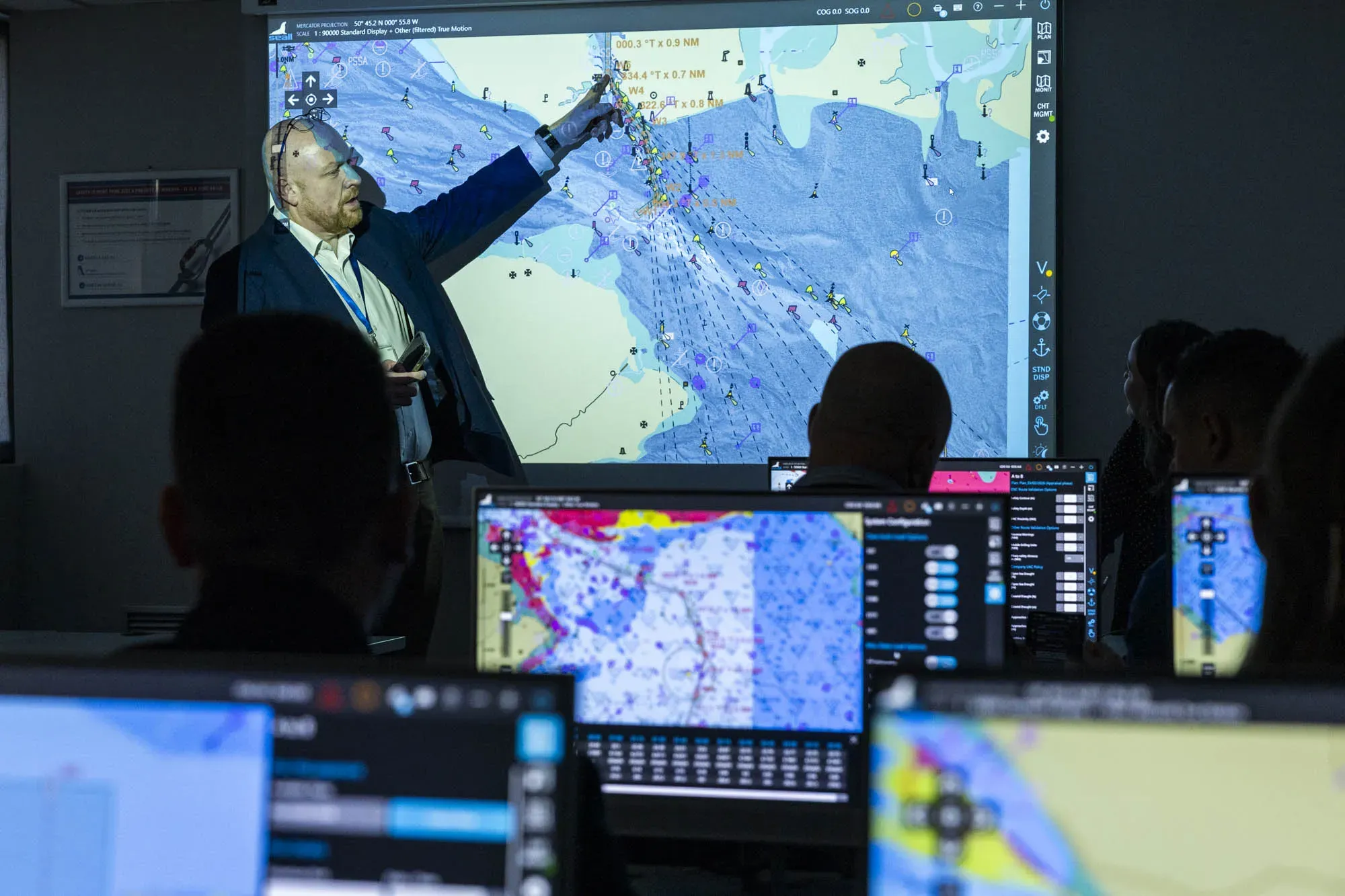
Testing S-100 in a realistic commercial passage scenario
Participants were tasked with planning and executing a simulated passage from Portsmouth Pilot Station to Fawley Oil Terminal.
Bridge teams first completed route planning using S-57 data before progressively introducing S-100 data layers. This allowed them to assess how additional information influenced route validation and decision-making at each stage of the passage.
What changed when S-100 was applied?
Body"What these trials show is how S-100 can support mariners in practice. When you bring together bathymetry, water levels and surface currents in a single display, it becomes easier to understand what is happening around the vessel and make informed decisions.
"At the same time, the feedback reinforces the importance of clear presentation, training and a controlled introduction, so crews can use that information with confidence.”
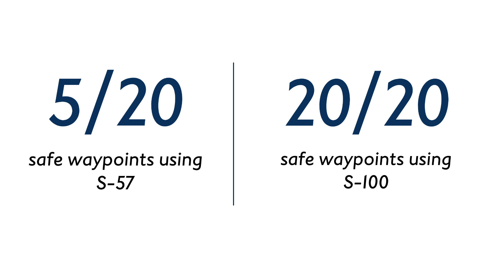
1. More safe navigation options identified
One of the most notable findings was the impact of S-100 data on route validation.
Participants were able to plan routes that would previously have been considered inaccessible when using S-57 ENC data alone. In the simulated scenarios, only 5 out of 20 planned waypoints were considered safe using S-57 data, compared with 20 out of 20 after S-100 layers and timing adjustments were applied.
This illustrates how combining bathymetry and tidal data can support more informed decision making, particularly in constrained or time-sensitive environments.
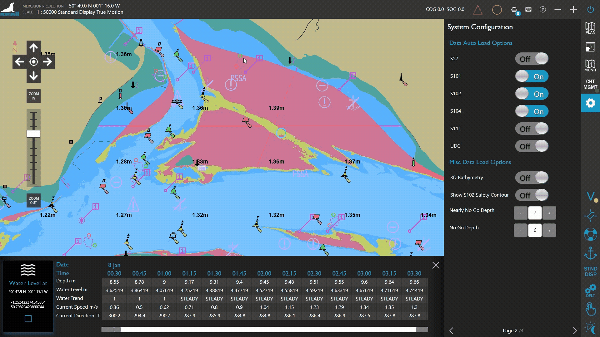
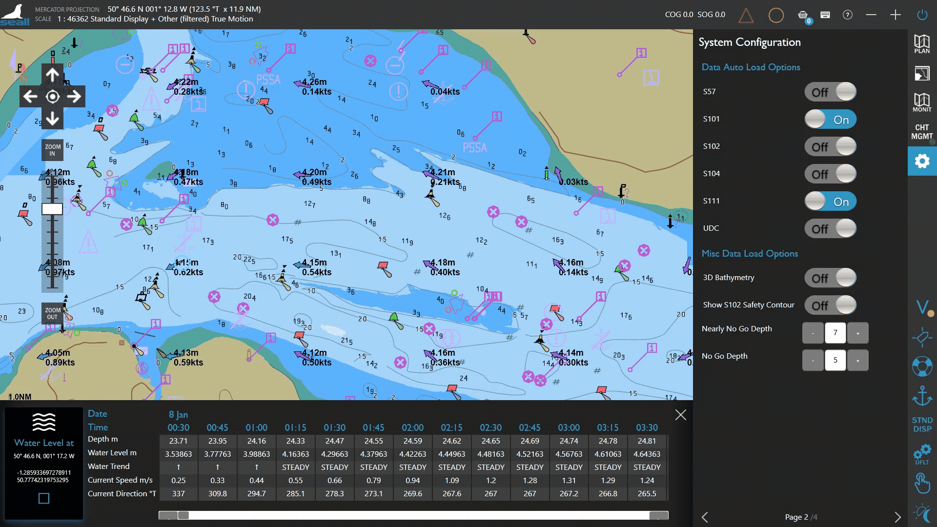
Route optimisation using S-100 data
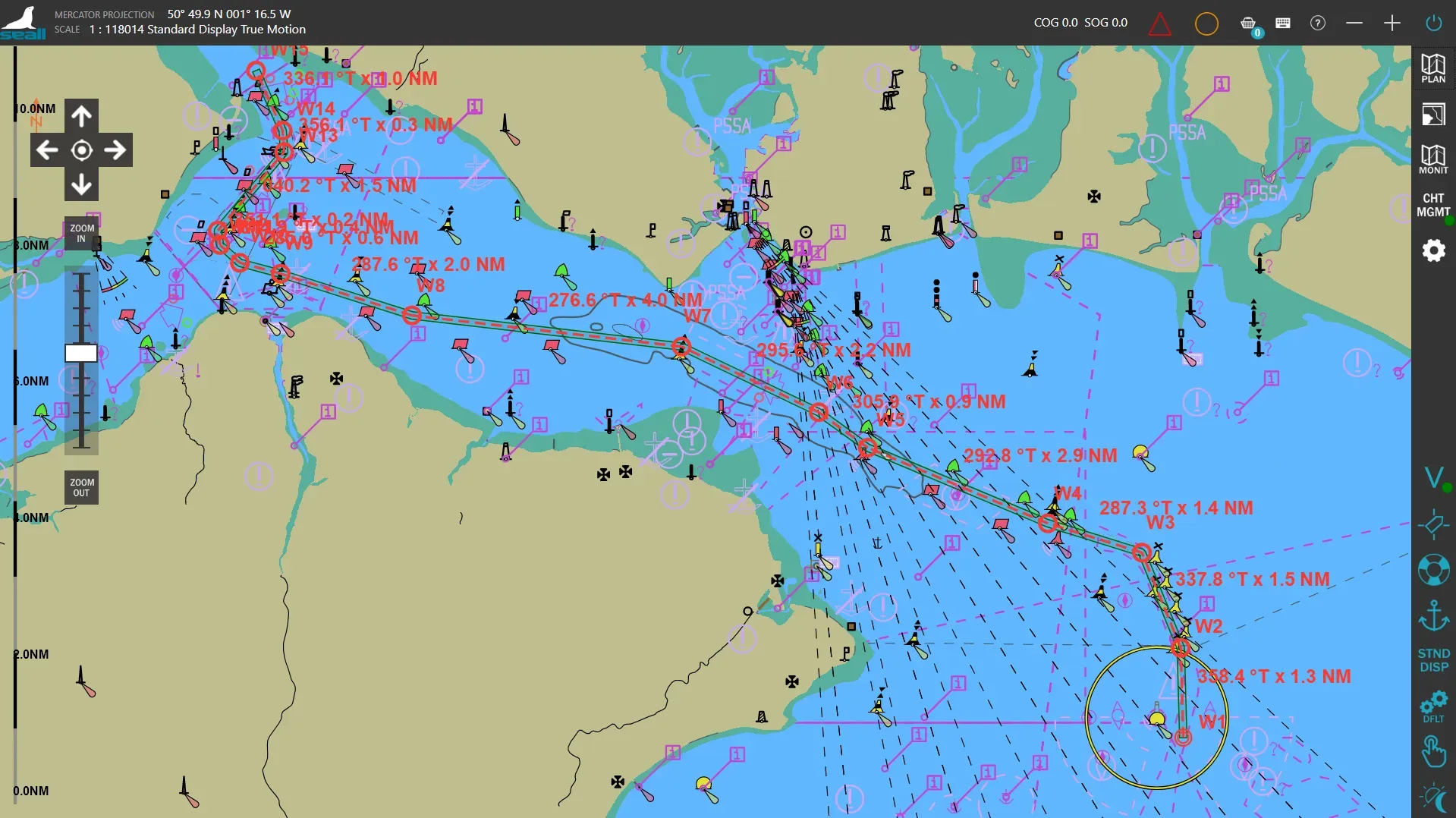
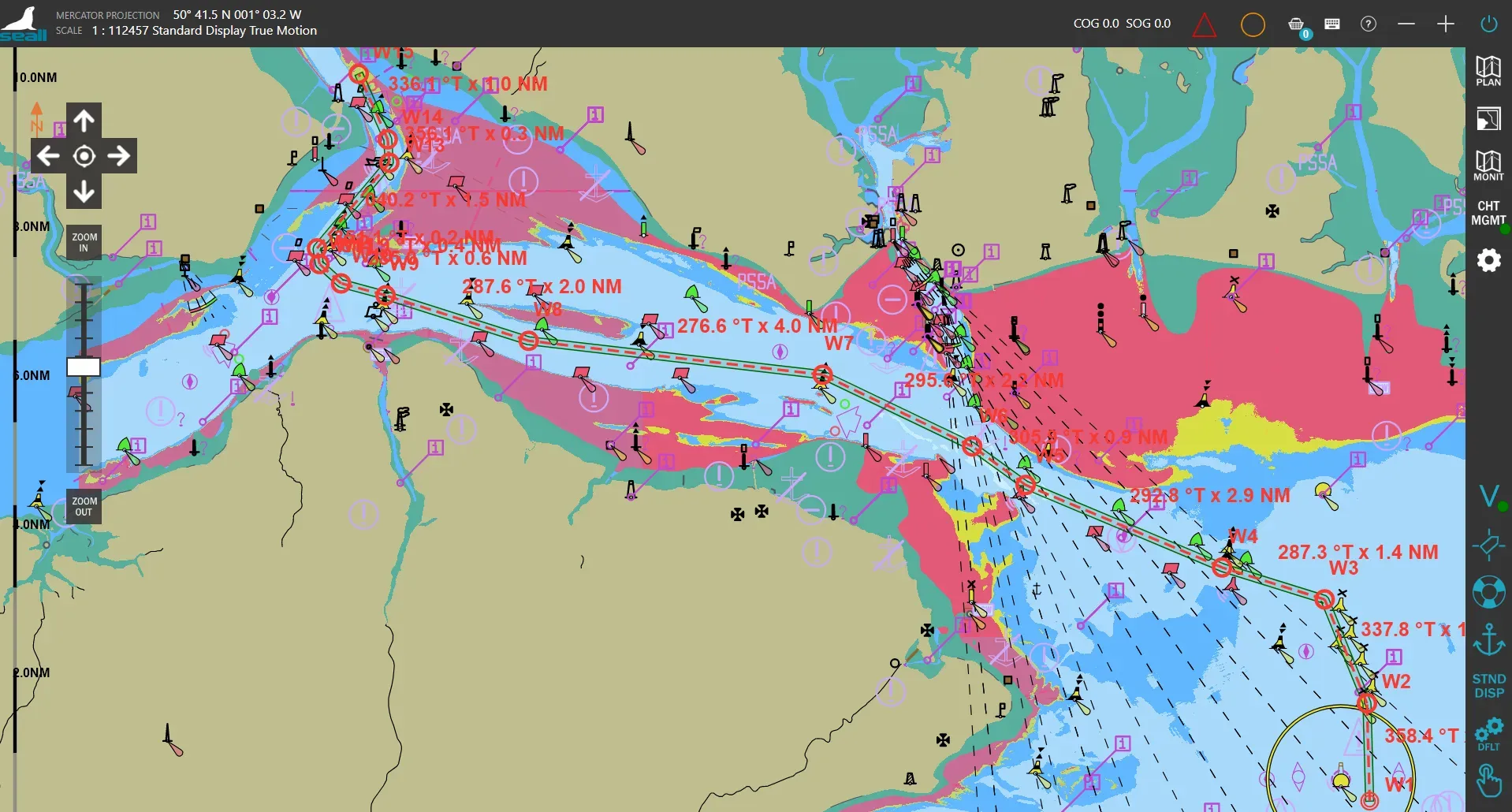
The images above show one stage of the route optimisation exercise undertaken during the trials. As additional S-100 layers were introduced, navigators gained a more precise understanding of available navigable water in constrained areas, increasing the number of safe waypoint options.
On the left: route displayed before the introduction of S-102 bathymetric surface data.
On the right: route after S-102 data was introduced, increasing the amount of safely navigable water available to the vessel and enabling additional safe waypoint options to be identified.

2. Clearer, more usable chart displays
Participants consistently highlighted improvements in how information is presented within S-100. Enhancements such as auto-rotated text, clearer symbology and more intuitive visual cues were seen to reduce chart clutter and make key information easier to interpret during navigation.
All participants agreed that rotated text improved chart clarity, while updated buoyage presentation was widely seen as better aligned with real-world conditions.
3. More efficient and integrated planning
S-100 enables multiple data types to be viewed together within a single system, reducing the need to consult separate sources. Participants noted that bringing together bathymetry, water levels and surface currents in one place can support more efficient planning and reduce the time spent cross-referencing traditional materials such as tide tables.
Dynamic water level data (S-104) was seen as particularly valuable for supporting under keel clearance calculations and planning safe transit windows.
Image shows UKHO S-104 data (The Brambles, Solent) visualised on a Seall ECDIS unit.
4. Greatest value in higher-risk environments
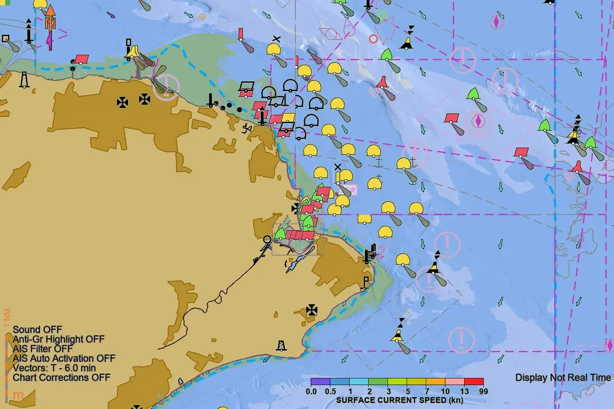
The benefits of S-100 were most evident in scenarios where precision is critical. Participants identified pilotage, confined waters and berthing as areas where additional data layers provide the greatest value, supporting safer manoeuvring and improved awareness of changing conditions. Surface current data (S-111) was also seen as particularly useful in these environments.
Image shows UKHO S-111 data (The Brambles, Solent) visualised on a Seall ECDIS unit.
Download the full technical report
A detailed summary of this simulator trial, including methodology, participant feedback survey and full findings, is available below.
Supporting safe S-100 adoption in practice
While feedback was broadly positive, participants also highlighted important considerations for implementation. These included the need for clear and intuitive user interfaces, maintaining visibility of critical features when multiple data layers are active, and avoiding over-reliance on automated calculations.
There was strong support for early adoption of S-100, alongside a clear emphasis on training and familiarisation. This reflects the importance of a controlled and well-supported transition, particularly during the period where S-57 and S-100 systems are used in parallel.
Building evidence for the transition to S-100 in use
These trials form part of a growing body of evidence on how S-100 performs in operational scenarios.
By working directly with mariners across different vessel types, the UKHO and its partners are building a clearer understanding of how S-100 can be used in practice — where it supports decision-making, and where further refinement will be important.
This approach helps ensure that the development of S-100 remains grounded in real-world use, supporting a transition that reflects both the opportunities and the practical considerations identified by those on the bridge.
Explore more S-100 trials
This case study forms part of a wider programme of S-100 testing and evaluation.
Access S-100 trial data sets
This simulator trial in Greece used S-100 data from the UKHO and Shom's International Hydrographic Organization (IHO) official trial testbed. You can see this official S-100 data to explore integration within new S-100 ECDIS software and share your experiences to help shape the next generation of navigational products.
Read more on this topic

Search Title
S-100 tested by experienced commercial mariners in Greece
Simulator trials conducted with commercial mariners from leading tanker, LNG and bulk fleets have provided new insight into how S-100 performs in practice, highlighting improvements in clarity, decision-making and planning — alongside the need for careful implementation and training.
Search Title
ECDIS Ltd S-100 simulator trial
In February 2026, the UK Hydrographic Office (UKHO) brought S-100 data into a live training environment at ECDIS Ltd, working alongside industry partners to explore how the next generation of hydrographic data performs in realistic navigation scenarios.