 Skip to main content

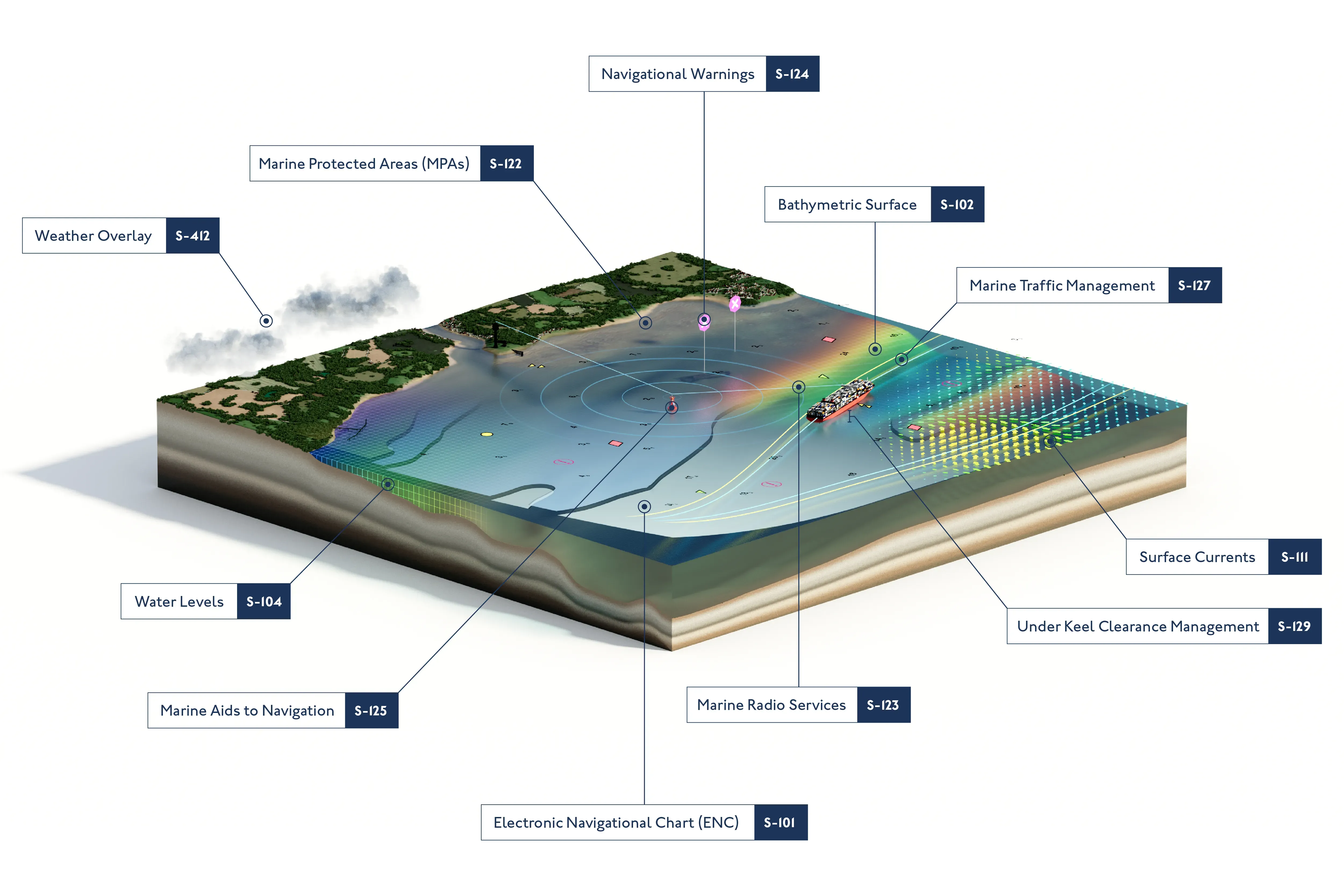
What is S-100?
S-100 is a new data framework being introduced by the International Hydrographic Office (IHO) that will underpin the next generation of navigation technologies. By providing a universal standard, S-100 could improve the accessibility, compatibility and usability of hydrographic and marine data. This includes the next generation of Electronic Navigational Charts (ENCs), bathymetry, tidal information and much more.
These new standards could enrich the way data is shared and displayed for maritime and geospatial users. By offering a much more complete picture of the maritime environment, users could be empowered to make more informed decisions based on precise, accurate and timely marine data.
The UK Hydrographic Office (UKHO) is committed to raising awareness and furthering understanding of S-100 across the maritime industry. Through collaborative development, testing of new data sets and real-world sea trials, we are supporting industry preparation for the changes ahead.
Keep up to date with the latest developments by subscribing to our S-100 mailing list.
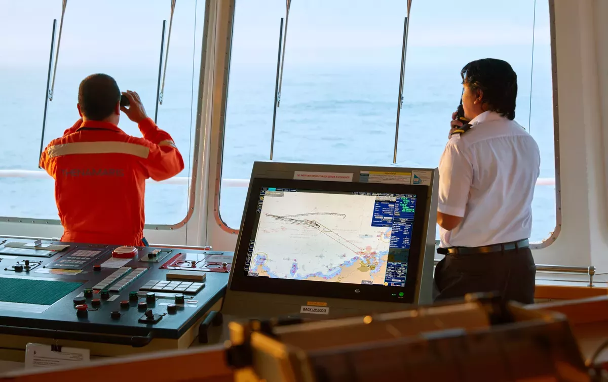
Supporting safety
By bringing multiple data layers into a single view, S-100 will improve clarity and confidence on the bridge.
The next generation of S-101 ENCs will provide a clutter-free ECDIS display for better usability, while powerful data overlays will provide high-resolution bathymetry and dynamic tidal information to help users navigate complex waterways with ease.
Enhancing efficiencies
With more granular and timely data, S-100 will help enhance efficiencies from ship to shore.
By combining bathymetry, water levels and surface currents data, users will have access to dynamic data on the ocean environment and its conditions, providing the basis for more efficient decisions around navigation, cargo loading, and port entry and exit.
Optimising voyages
Dynamic tidal data can support calculations for Just in Time arrivals based on real-time conditions.
By taking advantage of favourable tides, users can optimise their fuel consumption for more efficient voyages, reducing emissions and helping to support industry-wide decarbonisation efforts.
Fit for the future
S-100 data is being developed with the future of navigation in mind.
Enabled by maritime connectivity, S-100 data sets will be fully machine-readable to ensure they are futureproof for the navigational technologies of tomorrow. This will enable seamless on-board automation, as well as laying the foundations for remotely controlled and uncrewed vessels of the future.
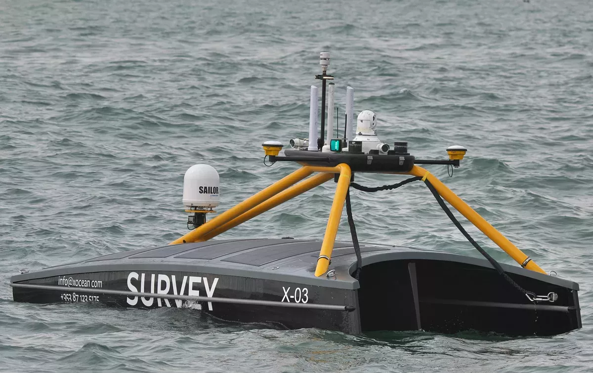
Image credit: XOCEAN
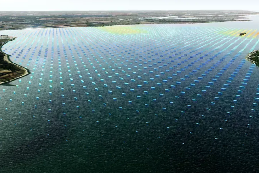
What could the future of navigation look like?
Our interactive experience brings S-100 to life, demonstrating how different data layers could connect and interact dynamically to support better situational awareness, decision making and safety at sea. Experience how integrated data streams could create a comprehensive view of the maritime environment.
Discover ‘phase 1’ product specifications
Click below to find out more about the ‘phase 1’ product specifications in development.
S-101: Electronic Navigational Charts
S-101 is the foundation data layer for future S-100 data sets and will replace S-57 (the format used for ENCs today).
S-101 will provide a base chart layer over which other powerful data sets will be overlaid, allowing for a much more dynamic and interoperable display of data in ECDIS.
S-102: Bathymetric surface
S-102 is the data layer for bathymetric surface, containing high-resolution profiles of the seafloor.
With much more granular information, S-102 can open up more navigable space to transit and manoeuvre – reducing risk and complexity when navigating shallow, confined or highly congested waterways.
S-104: Water levels
S-104 is the data layer for water levels information, helping users understand the changes in water levels for dynamic tidal applications.
When used in S-100-enabled tidal models, this data can provide more accurate tidal forecasts to support maritime navigation and port operations.
S-111: Surface currents
S-111 is the data layer for surface currents. This provides information on the horizonal movement of water, represented by both speed and direction, which is vital for maintaining navigational safety – particularly in constrained areas.
S-100 international test bed data
In support of the development, testing and use of future S-100 products and services, we’ve created a range of S-100 trial data sets that are free to download.
What are industry experts saying about S-100?
Whether you’re already familiar with its potential or keen to understand the basics, we’re here to help you prepare.
Webinar series: Shaping the future of navigation with S-100
Our ‘Shaping the future of navigation’ webinar series brought together industry experts to explore how the S-100 framework could transform marine navigation through interoperable data and smarter decision making.
Both sessions covered a wide range of topics, from the development and testing of S-100 to practical steps for implementation. Key discussions included advancements in next-generation ENCs, dynamic safety contours, real-time data integration, and how S-100 could underpin future technologies like automation and autonomous navigation.
S-100 in practice
Discover how we are testing S-100 in operational scenarios through live sea trials and simulated testing collaborations.
As the industry prepares for the transition to S-100, understanding how new data products perform in operational environments is essential. Across the sector, hydrographic offices, equipment manufacturers, ports, training providers and mariners are working together to test S-100 data sets and systems in realistic bridge scenarios.
Subscribe to keep updated on S-100
If you would like to keep updated on the UKHO's latest developments with regards to S-100 standards and the next generation of navigation, subscribe using the link below.